North and Central America (continent)
Found in 5483 Collections and/or Records:
Making hats, Antigua, 1912
155 x 115 mm. Showing a group of Antiguan women weaving straw hats.
Making tortillas in an Indian village, 1911
161 x 119 mm. A view inside an Indian hut showing cooking implements and a small fire. With an Indian woman posing for the camera.
Malahat Drive, Vancouver Island, 1919
Malcolm MacDonald photograph collection
Maligne Lake, Jasper National Park, Alberta , 1950 - 1967
A view looking across the lake towards distant mountains.
[Man and woman], 1949-02-10
50 x 110 mm. Both are dressed formally as if for a dinner party and are holding glasses of wine. This may be the occasion of Commodore Grassi's farewell party.
[Man chopping wood outside a cabin], 1910 - 1930
A series of slides showing the CCCS's work among rural communities in Canada. The series also contains a few slides of historical events.
[Man on horse], 1910 - 1930
A series of slides showing the CCCS's work among rural communities in Canada. The series also contains a few slides of historical events.
[Man with baseball bat], 1952
84 x 64 mm. A man, possibly Johnny Verhagen, swinging a bat, watched by a woman. The photograph is undated, but was found in a wallet from Montreal dated 15 October 1952.
Man with seal skin, 1902 - 1912
Mandeville, 1880 - 1889
208 x 132 mm. A view showing an open grassy square in Mandeville with a crowd of Jamaicans in the background (event unidentified).
Manitoba, 1962 - 1969
These files include annual reports, accompanied in some cases by explanatory letters, reports of annual general meetings, statements of accounts and other papers.
Manitoba welcomes visitors , 1950 - 1967
Showing the 'Welcome to Manitoba' sign 68 miles outside Winnipeg.
[Maniton, Near Colorado Springs], 1885
251 x 150 mm. A view from a hillside above the town, looking down on Maniton Springs, a small settlement five miles west of Colorado Springs. The town lies in a hollow at the foot of Pike’s Peak, and in the background can be seen the southern end of the Rocky Mountain Range. Photograph probably by W.H. Jackson.
Manuscripts relating to America in the British Museum, 1895, 1895
Extracts from 'The Nation', Vol. 61: Nos. 1574, 1581, 1582.
Manuscripts relating to Barbados preserved at the Bodleian Library, Oxford, 1908 - 1915
Copies of material in MSS Clarendon 81-85.
Manwayne Post Office Lloydminster District, 1910 - 1930
A series of slides showing the CCCS's work among rural communities in Canada. The series also contains a few slides of historical events.
Many of Jamaica's main roadways are inadequate for the volume of vehicular traffic which they must handle. As a result of this the Government has had to undertake an extensive road improvement programme, 1959 - 1982
250 x 200 mm. Jamaica Information Service photograph.

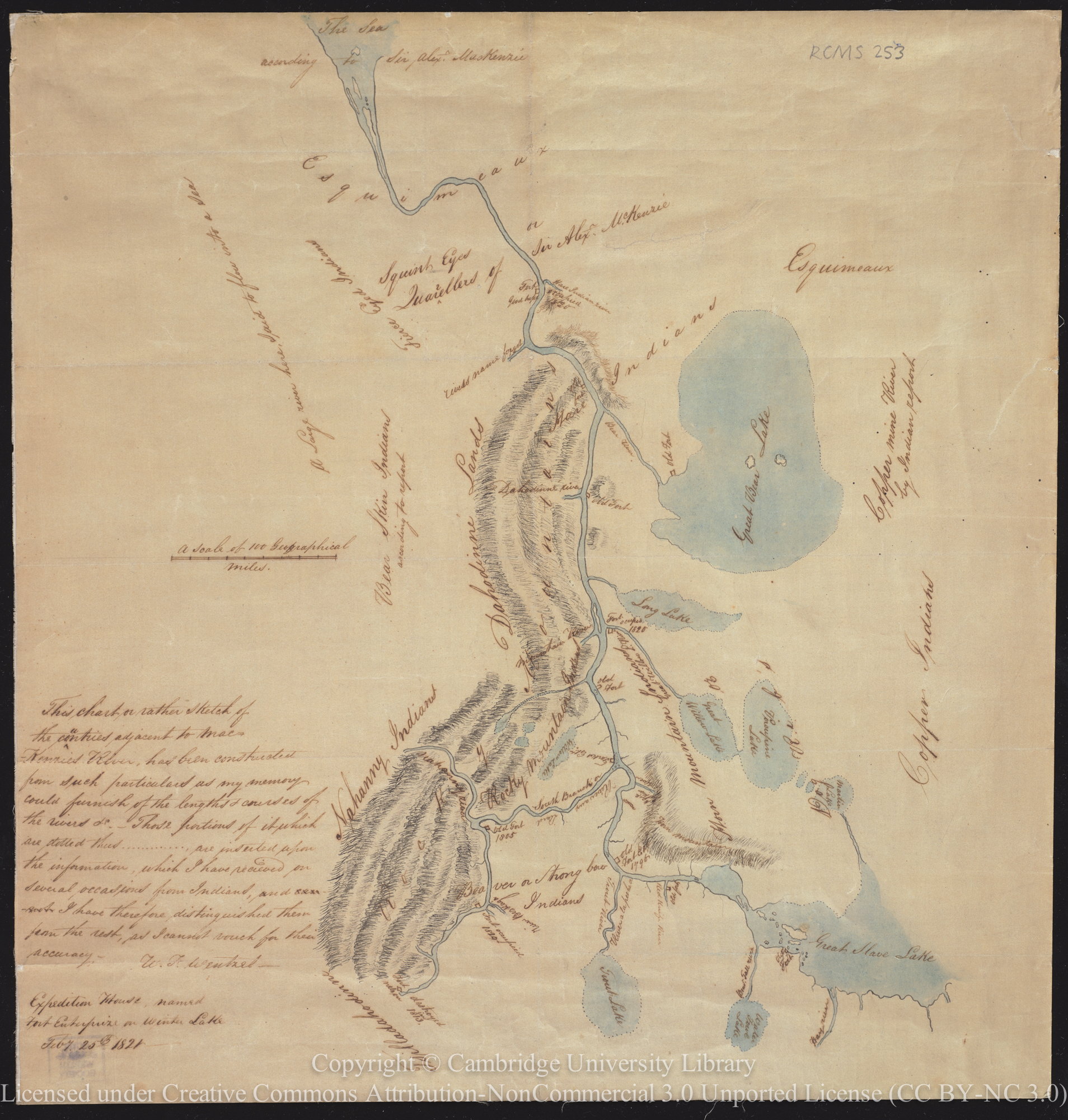
Map and account of the Mackenzie River
Map (394 x 420 mm) and brief description (7 pages) of the river’s geography, Indigenous Peoples, exploration and significance.
[Map of Africa, Rhodes' bookplates and various books on South Africa], 1939
Map of Sebastian Cabot, 1544, 1913
This is slide number four in Lecture 1.
Map of the island of Barbados divided into its parishes by H. Moll, 1736
Maple Leaves: Canadian History and Quebec Scenery (Third Series)
Maple sugaring, 1909
Quarter-plate. Joliette seen in the distance: cans fixed at base of the trees.
Maple sugaring, 1909
Quarter-plate. In the woods near Joliette : close of winter.
