Martinique (dependant state)
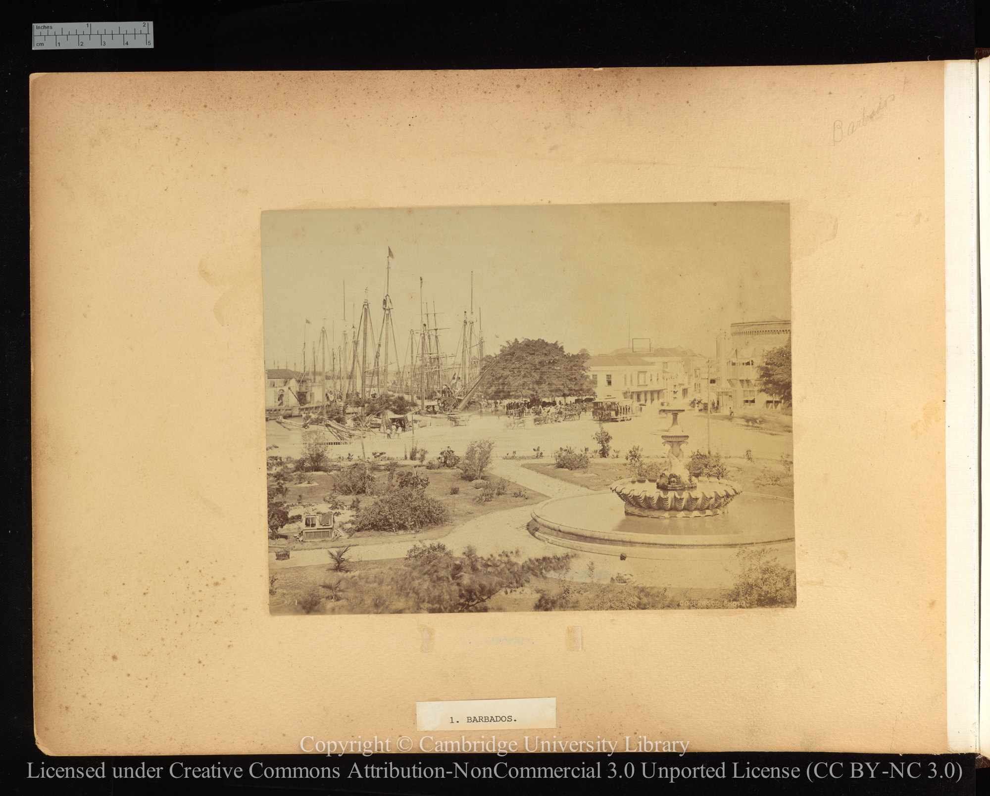
Found in 74 Collections and/or Records:
Magazine articles, 1885 - 1946
Martinique, 1880 - 1889
Martinique, 1880 - 1889
300 x 241 mm. A view looking north along the cobbled street of La Place Berlin with the partially obscured signal tower, le Sémaphore, at the left of the picture and masts of sailing-ships in the background. Le Sémaphore can also just be seen in the centre of Y307A/63, on the shoreline. With Mont Pelée in the distance.
Martinique, 1880 - 1889
240 x 290 mm. A view looking along a shop-lined street (probably la Rue Victor-Hugo in St Pierre) with the blurred figure of Martiniquans, and one European holding an umbrella against the sun and standing still for the photographer.
Martinique, 1880 - 1889
220 x 171 mm. A view showing residential houses and a church in St Pierre, with hills in the background.
Martinique Female Type, 1880 - 1889
A head and shoulders portrait of a Martiniquan woman wearing the traditional ‘doullette’ and ‘madras’. 129 x 170 mm oval print. The image was used as the frontispiece to Lafcadio Hearn’s ‘Two years in the French West Indies’ (1902).
Martinique Market woman [probably, in fact, Guadeloupe], 1880 - 1889
241 x 297 mm. A studio portrait against a painted backdrop of jungle trees showing a market woman posed with her foot on a wicker basket and wearing a straw hat.
Morne-Rouge L'Eruption qui précéda de quelques heures celle qui détruisit le bourg le 30 août 1902, 1902
133 x 88 mm.
[Open area and hills], 1902-05
80 x 55 mm.
[Open area with extensive debris], 1902-05
80 x 55 mm. And hills in the background.
Palmerale du Jardin Botanique, 1900
133 x 88 mm.
Photographs of the West Indies
Plan de la Ville St-Pierre, 1900
133 x 88 mm.
Point between Carbet and St Pierre, 1902
192 x 127 mm. A view from offshore showing the shell of a large building near the beach with hills in the background.
Point of Carbat, Nr. St Pierre, 1879 - 1913
265 x 180 mm. A beach scene at Carbet (sic) with a man and a rowing boat in the foreground of the palm-fringed beach. Carbet lies a few miles due south of Saint Pierre on the west coast of Martinique.
Principal Cross Street, 1902
204 x 153 mm. A view showing rubble and raised buildings in one of the streets which cross with Rue Victor Hugo, with a man standing among the fallen masonry in the foreground.
[Rue Victor Hugo (?)], 1902-05
80 x 55 mm. Two sides of the street with debris piled between the houses.
[Rue Victor Hugo (?)], 1902-05
80 x 55 mm. View with bodies in the foreground.
[Rue Victor Hugo], 1902-05
80 x 55 mm.
Rue Victor Hugo, 1900
133 x 88 mm.
Rue Victor Hugo looking north, 1902
192 x 127 mm. A view showing ruined buildings and rubble in the Rue Victor Hugo.
Rue Victor Hugo looking north, 1902
203 x 152 mm. A view showing ruined buildings and rubble in the Rue Victor Hugo, with hills in the distance.
Rue Victor Hugo looking south, 1902
191 x 127 mm. A view looking along the Rue Victor Hugo showing ruined buildings and the street filled with rubble. See postcard No. 2 for a view of the street before the disaster.
Rue Victor Hugo looking south, 1902
203 x 152 mm. A view showing ruined buildings, rubble and volcanic ash in the Rue Victor Hugo.
[Ruined interior of large buildings], 1902-05
55 x 80 mm.