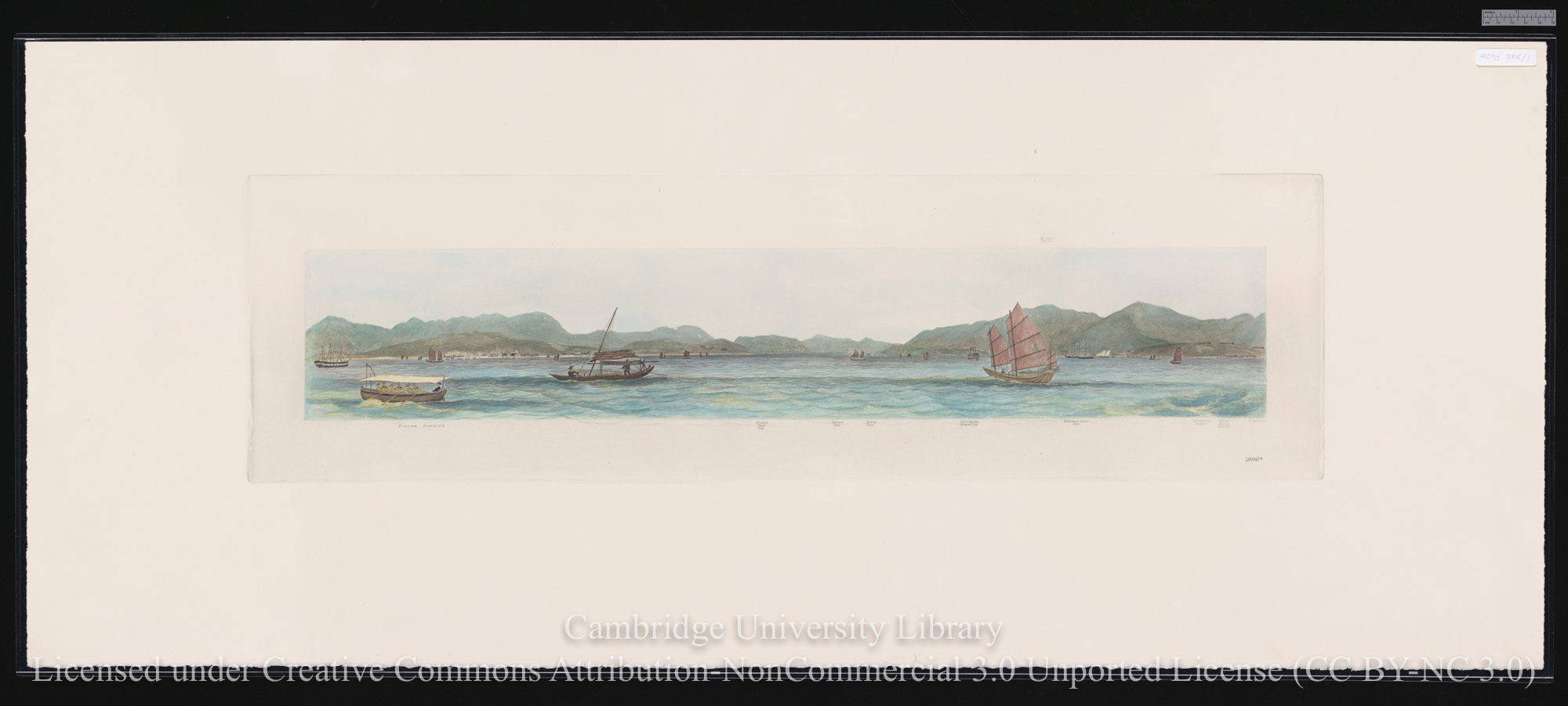
'Hong Kong as seen from the anchorage'. Drawn by Lieutenant L.G. Heath of HMS Iris (1846)
Scope and Contents
London: published according to Act of Parliament at the Hydrographic Office of the Admiralty, May 4th 1847
Commander (later Captain Sir Edward) Belcher of HMS Sulphur carried out a hydrographic survey of Hong Kong Island in 1841, and it was printed as Chart 1466 on 1 May 1843. Three engravings based upon Lieutenant L.G. Heath’s drawings were prepared by the Hydrographic Office to complement Belcher’s chart, and were published in 1847 as a three part panorama, measuring 127 x 2310 mm. in total. The individual sheets are numbered 1696a-c.
The RCS possesses two copies of Heath’s panorama: one is an original, RCMS 385/1; and the second is a colour reproduction, pulled from the original Admiralty copper plates, published in 1991 to commemorate the 150th anniversary of the cession of Hong Kong to the United Kingdom, RCMS 385/2.
Dates
- Creation: 1847 - 1991
Conditions Governing Access
Stored in the RCS Plan Chest.
Extent
6 sheet(s) : paper
Language of Materials
English
Physical Characteristics and Technical Requirements
fair condition
General
This item level description was entered by MJC.
- Date
- 2015-10-30 10:54:13+00:00
- Language of description
- English
- Script of description
- Latin
Repository Details
Part of the Cambridge University Library Repository
Cambridge University Library
West Road
Cambridge CB3 9DR United Kingdom
Map Dept enquiries: maps@lib.cam.ac.uk
all other enquiries: mss@lib.cam.ac.uk