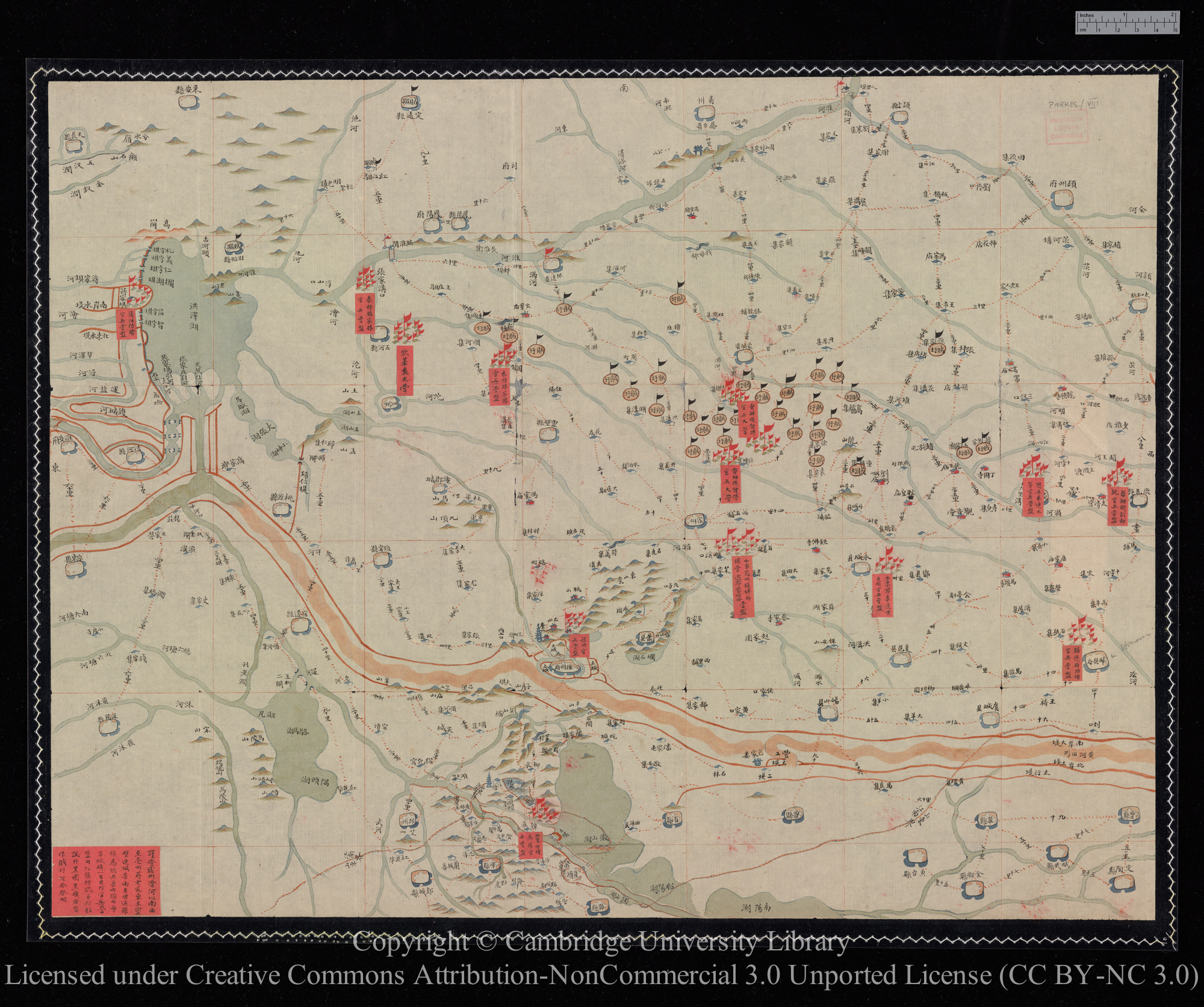
Chinese maps of eastern China, circa 1862
Scope and Contents
Two undated hand-painted maps in Chinese. Neither map gives the scale.
1. 'Huai pei ti shih kuan ping ta ying ch'ing hsing t'u' ['Map of the terrain of the region to the North of the Huai River and of the dispositions of great encampments of officers and men'], showing the area around Hsu-chou, northern Kiangsu, including parts of southern Shantung and northern Anhui. The map shows the dispositions of Nien rebels and Chinese Imperial army camps, and includes a note concerning areas controlled by the Niens, and labels concerning the places of origin of Imperial contingents.
2. Map of part of southern Shantung, centred on Yi-hsien (Tsao-chuang), and showing the eastern shore of Lake Weishan. The map is a section of the first map on a larger scale, and has labels concerning features of the localities.
Dates
- Creation: circa 1862
Creator
- From the Fonds: Parkes, Sir Harry Smith, 1828-1885 (Knight, diplomat) (Person)
Conditions Governing Access
Any person wishing to consult the collection must obtain written permission from Matheson and Co. Ltd. Applicants may submit their request an application form which is available from the Manuscripts Reading Room and via the University Library web pages at https://www.lib.cam.ac.uk/files/jm_application_form_2024_02.pdf. They should state specifically on the form that they desire access to the Parkes Papers.
Extent
2 folio(s) (2 folios)
Language of Materials
English
Repository Details
Part of the Cambridge University Library Repository
Cambridge University Library
West Road
Cambridge CB3 9DR United Kingdom
Map Dept enquiries: maps@lib.cam.ac.uk
all other enquiries: mss@lib.cam.ac.uk

